NEIGHBOURHOOD NOTE
Read an arts map without getting misled
The 2003 map reveals a cultural network. A present-day walk needs present-day addresses.
In this guide 9 sections
More than a row of galleries
The recovered 2003 map places art, design, museums, hotels and dining in a shared street grid. That arrangement explains the directory’s breadth: a gallery visit was presented as part of a neighbourhood experience. Numbered points alone cannot establish what is open today.
Separate geography from the listing
Second and Third Streets remain useful reference points, but institutions have moved. The Wood Turning Center appeared at 501 Vine Street in a 2003 directory; the current district lists the Museum for Art in Wood at 141 North Third Street. Pentimenti and Muse also have different current addresses from those in the early directory.
A second map reaches beyond the grid
A second recovered map has PDF creation metadata dated October 26, 2007. It labels InLiquid at 1400 North American Street and DaDa Rug & Art Gallery at 113 South 12th Street, with arrows beyond the central street grid. The guide’s cultural network therefore extended beyond a single compact gallery corridor. These are addresses in that document, not current visitor directions. The map supplies evidence of DaDa’s name and listed location; it does not recover the missing gallery page or establish a present programme.
Our map has a narrower job
The schematic on this site shows the relative position of ten places listed in the current district directory. It is not a survey, a walking-navigation service or a guarantee of accessibility. Use the street address and the venue’s own programme before travelling. Road works, crossings and entrances require on-site judgement.
A simple map-reading procedure
First choose two or three places. Second verify their opening arrangements. Third locate the relevant streets and a transport stop. Fourth decide where to pause. Keep a backup venue only if its programme is also confirmed. This reduces a long list to a visit you can realistically complete.
When an old address helps
An old address can explain an exhibition reference, an artist biography or a neighbourhood photograph. It should not silently become a current directions link. Our notebooks retain dates with their descriptions and link to a current place page only where the connection has been checked.
Read the key before choosing a route
The complete map created in October 2007 distinguishes four categories: visual and performing arts, design arts, museums and lodging, and restaurants. Subway, parking and points of interest have separate symbols. A numbered square identifies a listing; it does not tell you the entrance, programme time or access arrangements. The arrows for InLiquid and DaDa point beyond the central drawing. Do not treat the edge of a printed map as the edge of the cultural network.
One transport stop can serve many venues
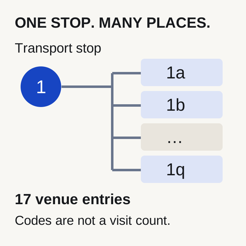
A further complete two-page document survives on The Clay Studio’s former website: the Old City Route excerpt from the NCECA 2010 conference programme, printed pages 58–59. It identifies one transport stop near Second and Arch Streets, then gives separate venue entries numbered 1a through 1q. Those entries include galleries, a studio, restaurants and other cultural places. “One stop” belongs to the transport route; it does not mean one exhibition or one visit. The programme’s 2010 addresses, exhibition dates and reception times remain specific to that conference.
From a printed pin to a usable visit
- 01Identify the symbol
Read the legend: category, transport stop, parking or point of interest. Then find the matching numbered listing. A shared number is meaningful only within its own guide.
- 02Verify the destination
Record the institution’s current visitor address and the specific programme page. Confirm date, entry rules and entrance assistance. An off-frame arrow requires a separate location check.
- 03Build a small plan
Choose two confirmed venues, budget looking and travel time, and keep a fallback. If a required address or access detail is unresolved, confirm it before making the journey.
A filled planning example you can adapt
Illustrative plan: two venues showing works on paper; one question — how line changes across two different media; looking time — 25 minutes at each; travel allowance — 20 minutes; rest and contingency — 20 minutes. The budget is 90 minutes: 25 + 25 + 20 + 20. These are chosen allowances, not measured journey times. Before using the plan, fill in both names, current visitor addresses, programme URLs, confirmed opening times and access answers from the venues. If the actual journey needs more than 20 minutes, extend the plan or remove a stop. If a venue is unavailable, use only a separately confirmed fallback.
Copy this worksheet into your notebook: purpose / two destinations / source for each programme / date and arrival window / entrance and access answers / looking time / actual journey estimate / contingency / fallback. Keep transport-stop codes and venue codes in separate fields. Your finished plan should explain where to go and why, rather than merely reproduce all the pins on a brochure.
Sources & further reading
- web.archive.org/web/20111110035650/http://www.theclaystudio.org/pdf/NCECA10_OldCity.pdf
- web.archive.org/web/20081120055545/http://www.oldcityarts.org/map/main/map.html
- web.archive.org/web/20070721022025/http://www.oldcityarts.org/map/main/map.pdf
- web.archive.org/web/20130717212516/http://www.oldcityarts.org:80/map/main/images/oca%20map%2012.75.pdf
- web.archive.org/web/20040611092356/http://www.oldcityarts.org:80/map/main/oldcitymap.pdf
- web.archive.org/web/20030826173751/http://www.oldcityarts.org:80/map/main/map.html